

In this guide
What should you know before hiking in Malta?
What are the best hiking trails in Malta and Gozo?
How do you plan a hiking trip to Malta?
What makes Malta’s hiking trails uniquely special?
An honest take on hiking in Malta
What should you know before hiking in Malta?
Malta’s hiking culture is genuinely exciting, but it is young, and that shapes the entire experience on the ground. Unlike Alpine or Scottish hiking destinations with colour-coded waymark systems and mountain huts, Malta operates with sporadic red, blue, or yellow dot waymarks that appear on rocks and then disappear without warning. Hikers here navigate using downloaded GPS tracks, printed maps, or detailed route descriptions rather than following signs from trailhead to summit.
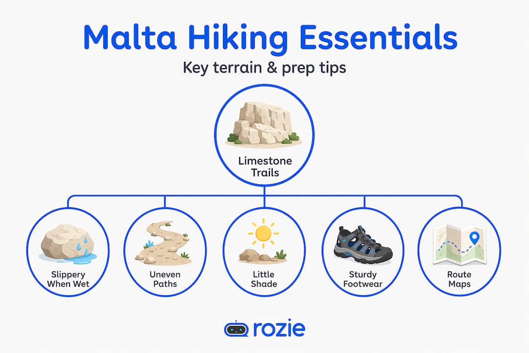
The terrain is overwhelmingly Globigerina and Coralline limestone. That means rugged, uneven ground that can be sharp underfoot and surprisingly slippery when wet. Coastal paths hug clifftops that are beautiful but genuinely brittle: the famous Azure Window on Gozo collapsed during a storm in 2017, which is a useful reminder to stay well back from any edge that looks fractured. Some inland routes also cross private farmland, so stick to established paths and leave gates as you find them.
Seasonality matters more in Malta than in almost any other Mediterranean hiking destination. Summer hiking from June through September is uncomfortable and can be dangerous, with temperatures regularly above 35°C and almost no shade on exposed ridges or coastal paths. The reliable hiking window runs from late October to early May, when temperatures sit between 12–22°C, the landscape turns visibly greener after the first autumn rains, and the lower-angle light makes coastal photography extraordinary.
Here are the conditions to prepare for before you lace up your boots:
- Terrain: Sharp limestone, loose rubble on descents, and muddy agricultural tracks for a day or two after rain.
- Shade: Almost none on coastal and ridge routes; sun exposure is relentless from mid-morning onward, even in spring.
- Signage: Inconsistent at best; offline GPS navigation is not optional, it is required on anything beyond a short urban walk.
- Cliffs: Coastal paths involve real exposure; keep a clear margin from edges and avoid fractured-looking rock.
- Private land: Several routes cross farmland; pass through respectfully and close any gate you opened.
Pro tip
Download your chosen route on Komoot, Wikiloc, or AllTrails before you leave your accommodation, and switch on offline maps. Mobile data on remote clifftops can drop without warning, and an offline track saves you from a frustrating wrong turn an hour into a hike.
What are the best hiking trails in Malta and Gozo?
Komoot currently lists over 340 mapped hiking routes across the Maltese islands, and Visit Malta publishes its own walks portal with curated routes by terrain and difficulty. That is genuinely impressive variety for a country of 316 square kilometres. The six routes below are the ones worth prioritising on a first hiking trip, organised from easy half-day walks to a full-day Gozo circuit.
If you only have time for one route, the Victoria Lines western section is the obvious pick. Built by the British military between 1875 and 1899 along the geological Great Fault, the Victoria Lines fortifications span the full 12-kilometre width of Malta and were nicknamed the “Great Wall of Malta.” The western stretch from near Rabat to Bingčemma Gap is the most photogenic and best preserved, with the wall running along a dramatic escarpment, sea views on both sides at the Gap, and three forts (Bingčemma, Mosta, and Madliena) along the wider route. Allow about 2.5 hours, pack a real lunch, and budget time at Bingčemma to actually sit and look.
The eastern section of the Victoria Lines is a shorter alternative if you want a taste of the same history with less commitment. The middle stretch of the original wall has not survived, so you cannot walk the full 12 kilometres in one continuous push without using transport to bridge the gap. The eastern stretch ends at Fort Madliena and takes about 50 minutes at a comfortable pace.
Golden Bay to Gnejna Bay is the standout coastal route for first-time hikers. The path crosses red clay slopes and limestone ridges between two of Malta’s most photogenic beaches, both inside Il-Majjistral Nature and History Park, which is the country’s only formally designated hiking park. It is manageable for most fitness levels, and the dramatic clay descent into Gnejna remains the visual high point.
Dingli Cliffs and the Fawwara Trail sit at Malta’s highest point. Dingli Cliffs rise 253 metres above sea level on the southwest coast, with the tiny island of Filfla visible offshore on clear days. The Fawwara extension adds terraced fields, the small chapel of St Mary Magdalene on the clifftop, and a sense of remoteness that is hard to find on a 316-km² island.
Tal-Mixta Cave on Gozo is the shortest entry on this list and the easiest to fit into a half-day. The cave sits high on the eastern headland above Ramla Bay near Nadur and frames the famous red beach through a natural stone arch. From the parking area off Triq l-Għassa tal-Maħraġ, the walk is barely 5–10 minutes; from Ramla Bay itself, a steeper, rougher 15–30 minute climb up the eastern cliff puts you at the cave. Entry is free, the cave is on private property, and there are no toilets, shops, or guardrails.
For something genuinely physical, the Sanap Cliffs to Xlendi Bridge loop on Gozo is a moderate-to-hard 11-kilometre circuit with 320 metres of elevation gain along secluded coastline. It is one of the most consistently rated routes on Komoot and gives you the full Gozo character: dry stone walls, terraced fields, sea cliffs, and the bridge above Xlendi Bay.
How do you plan a hiking trip to Malta?
Logistics in Malta are simpler than they look. Public buses connect to most major trailheads and routes sync with Google Maps, but renting a car is genuinely worth considering, especially for Gozo. A car gives you flexibility to start early, reach quieter trailheads, and combine routes that public transit makes logistically awkward. Bus tickets cost €2.50 in summer or €2.00 in winter, with a €3.00 night fare.
For accommodation, Valletta is the smartest base for hiking the main island. It is central, well-served by buses, and full of post-hike restaurants. Sliema and St Julian’s work too if you prefer beachfront and an easier commute to Golden Bay. On Gozo, Victoria (locally called Rabat) sits at the geographic centre and puts most hiking routes within 20 minutes by car. Smaller villages like Xlendi, Marsalforn, and Nadur put you within walking distance of coastal trails if you want to skip the car entirely.
Packing right makes or breaks a day on Maltese trails. The sun is fierce even in March, and most routes offer zero shade. Here is what experienced local hikers actually carry:
- Water: Minimum 2 litres per person for any route over 5 km; there are no springs or fountains on Maltese trails.
- Sun protection: Sunscreen, a brimmed hat, and proper sunglasses are non-negotiable from March onward.
- Footwear: Trail shoes or light hiking boots with real grip; smooth-soled trainers are genuinely dangerous on damp limestone.
- Snacks: No cafés or vendors on most routes, including all remote Gozo trails.
- First aid: Basic blister kit and antiseptic for the small cuts that sharp limestone inevitably causes.
- Layers: A windproof shell from November to March; coastal exposure on the Great Fault ridge can drop the felt temperature by several degrees.
Pro tip
From April to October, plan to be on the trail by 08:00. The light is at its best, temperatures are manageable, and you will finish the main climb before the sun hits its full strength. You will also reach scenic viewpoints like Bingčemma Gap or Tal-Mixta Cave before the day-trippers arrive.
What makes Malta’s hiking trails uniquely special?
The genuine differentiator is the collision of deep history and raw natural scenery on every single walk. You are rarely more than a kilometre from a Neolithic temple, a medieval chapel, a British-era fortification, or a set of mysterious Bronze Age “cart ruts” carved directly into the limestone bedrock. That is unusual on a hike anywhere in Europe, and on a country this small it becomes the defining experience.
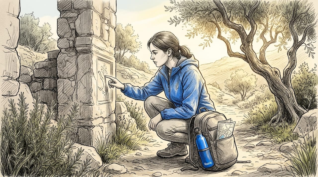
The Victoria Lines tell a particularly readable story. Built after the opening of the Suez Canal made Malta’s Grand Harbour critical to British Mediterranean strategy, the wall was designed to stop an invading force from landing in the north and reaching the harbour. It was never tested in battle, and the line was effectively obsolete by the First World War. Walking it now means moving past three forts, half-collapsed entrenchments, searchlight emplacements, and 1950s nuclear-bunker tunnels stacked into the same geological feature, the Great Fault. It is unusual to read a country’s defensive history with your feet, but Malta lets you.
On Gozo, the sense of isolation is real. Tal-Mixta Cave rewards careful timing: late morning sun angles light through the cave mouth and lights up Ramla Bay below; sunset is the more famous moment and brings small crowds. There is no fencing, no guardrails, and no staff. That rawness is exactly what makes it memorable, and it is the reason photographs of the cave look genuinely different from the polished images of well-managed European viewpoints.
Key takeaway: Malta’s hiking is not about grand elevation or remote wilderness. It is about layered history, coastal exposure, and trails where you might be alone with a 4,000-year-old cart track for an hour at a stretch.
A few more places worth seeking out beyond the headline routes:
- Wied il-Mielaħ Window, Gozo: A natural limestone arch at the cliff edge accessible on a short coastal walk near the village of Għarb. It is a quieter, less Instagrammed alternative to the lost Azure Window.
- Fomm ir-Riħ Bay, Malta: One of the country’s most secluded bays, accessible only on foot via a steep descent that filters out casual visitors. The Victoria Lines technically end here.
- Il-Majjistral Nature and History Park: Malta’s only formally protected hiking park, covering 6 km² of coastline between Golden Bay and Anchor Bay, with marked trails and free entry.
- Clapham Junction, Malta: An open area near Dingli with a dense field of prehistoric “cart ruts” parallel grooves cut into the bedrock whose origin is still debated by archaeologists.
- Comino: Reachable by ferry from Marfa or Čirkewwa, with a circular island trail of around 7 km that connects Crystal Lagoon, Blue Lagoon, and Santa Marija Tower. Best done outside peak summer.
An honest take on hiking in Malta
I have hiked in places with pristine trail infrastructure and colour-coded maps at every junction. Malta is not that, and honestly, I think that is part of what makes it rewarding. There is something genuinely satisfying about following a rocky clifftop where you are mostly on your own, navigating from a downloaded track, with no crowds and no gift shop at the top.
What I notice is that first-time hikers in Malta underestimate two things. First, the physical demand of limestone terrain. Flat-looking ground on a map can be relentlessly rough underfoot, and even moderate routes tire your feet fast. Second, the navigation challenge on routes where waymarks simply disappear. I have seen experienced hikers get genuinely frustrated when the red dots stop and the path forks with no indication of which way to go. Both are solvable: proper trail shoes plus an offline GPS track removes about 90% of the friction.
My honest recommendation for a first trip? Do the Victoria Lines western section first. It delivers history, views, physical engagement, and a natural lunch stop at Bingčemma Gap that makes you feel you have earned every bite. Then cross to Gozo for Tal-Mixta Cave and the Ramla Bay views, ideally on the same trip. That two-route combination gives you the full picture of what hiking Malta actually offers, compressed into two memorable days.
The scenic diversity between coastal and ridge trails is the strongest argument for spending more than a single day walking here. Give the trails a proper week and you will leave with sore legs, a camera full of pictures you cannot quite believe came from a country this small, and a clear plan to come back.
How do you come home to a clean space after a long hike?
The unromantic side of a good hiking day is what you walk back into. Boots caked in red trail dust, sandy laundry, salt-air windows that need wiping, a kitchen you didn’t touch before the early start, and a bathroom that needs to be more inviting than the trailhead’s portaloo. Whether you are based in a long-let rental in Sliema, an Airbnb in Mellieha, or your own place in Mosta, the same problem applies: nobody wants to spend a Sunday evening cleaning after a Saturday on the Victoria Lines.
The traditional Malta way of finding a cleaner means scrolling Facebook groups, sending messages to a handful of numbers, chasing vague quotes, and hoping someone reliable turns up on time. It is the same friction that quietly kills good plans, including hiking weekends, because the chores wait at the other end. Rozie was built to remove that friction. You post the cleaning request once, pick the date and any extras (oven, fridge, inside windows, balcony, terrace), and verified cleaners in Malta send you exact offers, usually within 5–15 minutes. You compare offers, accept the one you prefer, and every booking is covered by payment protection and up to €1,000,000 in professional liability insurance underwritten by Lloyd’s Insurance Company S.A. Here is the full booking flow in under 60 seconds:
If you are hosting guests at a holiday home and want everything turned around between stays, Rozie’s holiday home cleaning guide for Malta covers what to ask for and when. For broader practical advice across the cleaning side of Maltese home life, the cleaning in Malta archive is the easiest entry point.

FAQ
When is the best time of year for hiking in Malta?
The reliable hiking season in Malta runs from late October to early May, with temperatures between 12–22°C and the landscape at its greenest. Summer (June–September) regularly exceeds 35°C with almost no shade on coastal or ridge routes, which makes hiking uncomfortable and potentially unsafe.
How difficult are Malta’s hiking routes for beginners?
Many Malta routes are suitable for beginners, including the Golden Bay to Gnejna Bay coastal walk, the Victoria Lines eastern section, and Tal-Mixta Cave on Gozo. Limestone terrain is rougher underfoot than most beginners expect, so proper trail shoes and 2 litres of water per person matter even on the easier trails.
Do you need a guide for hiking in Gozo?
You do not need a guide for hiking in Gozo, but you should download an offline GPS track before you set off. Signage is inconsistent across both islands, and self-navigation with an offline map (Komoot, Wikiloc, or AllTrails) is the safest approach on routes where waymarks disappear.
How long is the Victoria Lines hiking trail?
The Victoria Lines fortifications span approximately 12 kilometres across the full width of Malta, from Madliena in the east to Bingčemma and Fomm ir-Riħ in the west. The middle stretch of the wall did not survive, so the hike is most commonly done in two sections: a western 9 km route ending at Bingčemma Gap and a shorter ~2.8 km eastern stretch ending at Fort Madliena.
How high are Dingli Cliffs?
Dingli Cliffs rise 253 metres above sea level on Malta’s southwest coast, making them the highest point on the islands. On a clear day the small island of Filfla is visible offshore, and St Mary Magdalene chapel sits near the clifftop.
Are there facilities on Malta’s hiking trails?
Most Malta and Gozo trails have no facilities at all. Sites like Tal-Mixta Cave, Fomm ir-Riħ Bay, and the wilder stretches of Il-Majjistral Park have no toilets, cafés, or staffed signage. Always carry your own water, food, and sun protection before setting out.
How do I keep my home or rental guest-ready when I’m hiking all weekend?
Post a cleaning request on Rozie, choose your date and any extras (oven, fridge, inside windows, balcony), and verified cleaners in Malta send you exact offers, usually within 5–15 minutes. You accept the cleaner you prefer, with payment protection and up to €1,000,000 in professional liability insurance built into every booking.